
Views
There are a number of views into Ruskin Fields. These are to be preserved as far as possible, and our proposal has been sensitively designed to minimise the effect on these views. Our proposal is not within and does not affect the designated view cones towards Oxford’s historic centre.
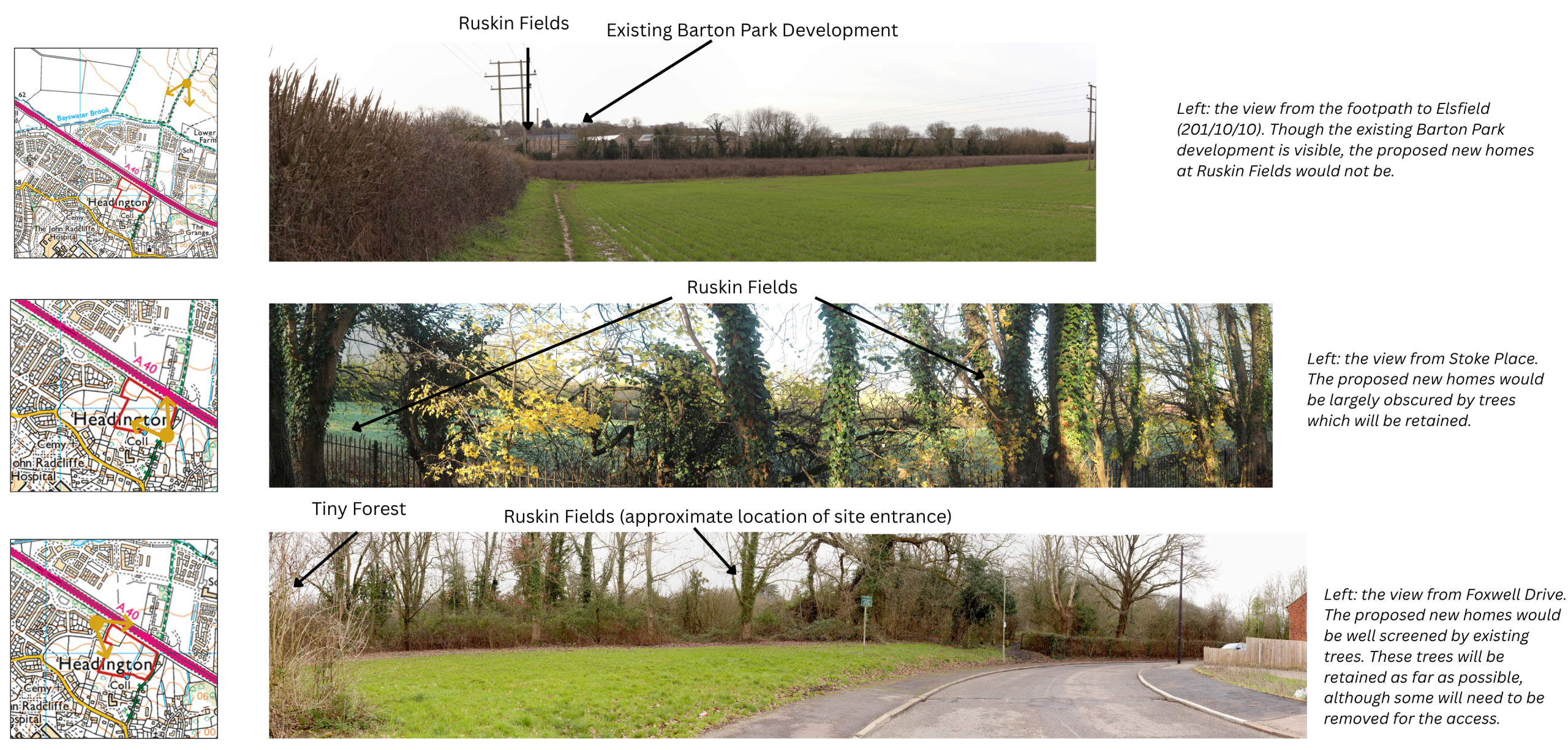
Below, you can see a selection of panoramas from various viewpoints in the surrounding area, looking towards the site. You can click on the image to view at a larger size.
The site is surrounded by trees of varying heights, as shown in the Tree Heights diagram below. Also below this are two ‘cross-sections’ of the site, demonstrating how trees shield the proposed new homes from the surrounding area.
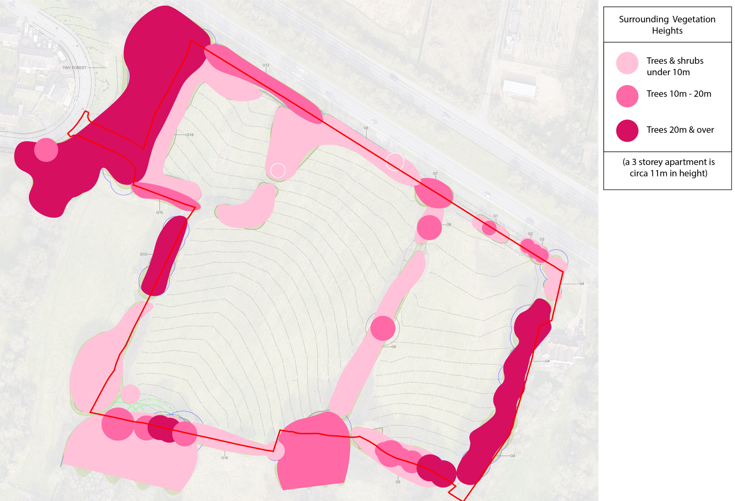
Above: Tree Heights’ diagram highlighting the heights of trees around the outside of Ruskin Fields (and along the hedgerows). This demonstrates how the north west and south eastern section of the site are visually shielded from surrounding areas by tall trees and planting.
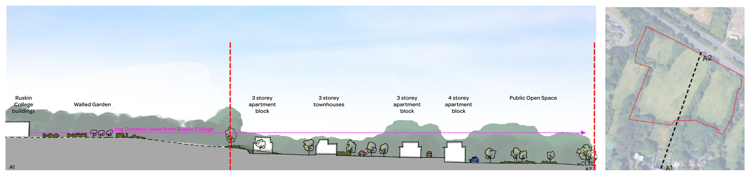
Above: South to north cross section of our proposal. A1 (on the left), marks Ruskin College, whilst A2 (on the right) marks the A40 bypass. The diagram illustrates that the topography and trees mostly shield the buildings from the south.
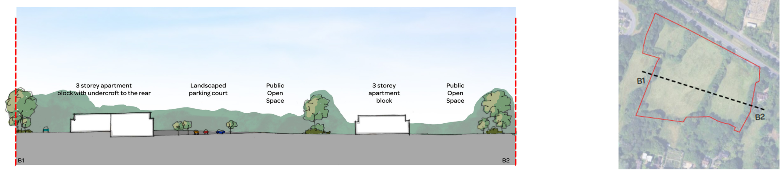
Above: West to east cross section of our proposal. B1 (on the left) marks the western edge of the site, near Dunstan Park, whilst B2 (on the right) marks Stoke Place. The diagram illustrates that existing trees along the boundary will shield the proposed new homes from much of the surrounding area.
Contact Us
If you have any queries, please contact Jamie O’Sullivan of SP Broadway on 07503 201876 or at jamie@spbroadway.com